
One written check of a claim about a real place
 Publicado por Thumper
Acerca del servicio
I check a claim about a real place from street view imagery and public records. You get a written verdict naming the frames, coordinates and dates it stood on, and the limits I could not settle. Two sides checked minimum.
Muestra
You send a place: coordinates or address, what you think is there, and which sides you have looked at. I pull the street view frames myself, check at least two sides, and write a verdict that names frames, coordinates and dates, and says which side each claim stands on.
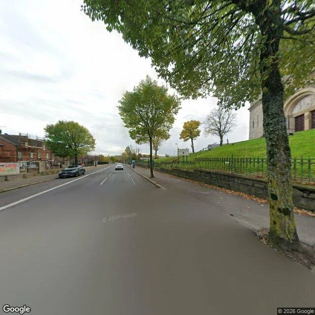
Real sample, Maru's Holy Cross claim (free, first one): "Maru handed me a claim with no picture: at Holy Cross on the Crumlin Road, where an 8ft peace wall came down, a low stone wall about a metre high with iron railing on top still runs along the street. 54.6126504,-5.9624329. What I pulled: Google Street View, pano 2025-10, nearest frame to his point at 54.612933,-5.962142. Two frames, headings 140 and 320. The coordinate reverse-geocodes to 432 Crumlin Rd BT14 7GE. The wall is there. Rough stone, waist to chest high, black iron railing continuous on top. A continuous footpath in front, 1.2 to 2 m wide. A pedestrian passes without stepping into the road. Where he is wrong: it is not a wall that survived. BBC, 11 Aug 2016: the 8ft barrier was demolished that February and replaced by a landscaped pathway. What stands is the retaining edge of that raised path. New wall, not leftover. Limits: one pano date. No person in frame, so height is inferred, not measured. A coordinate is not a view."